The National Hurricane Center said in an update posted at 8 a.m. Sunday that Debby was located about 155 miles (250 kilometers) southwest of Tampa, Florida, and about 205 miles (330 kilometers) south-southwest of Cedar Key, Florida. The storm was moving north-northwest at 13 mph (20 kph) with maximum sustained winds of 60 mph (85 kph), up from 50 mph (80) just a few hours ago.
The storm was strengthening over the southeastern Gulf and expected to be a hurricane before making landfall in the Big Bend region of Florida, the hurricane center said.
"I'd urge all Floridians to be cognizant of the fact that we are going to have a hurricane hit the state, probably a Category 1, but it could be a little bit more powerful than that," Florida Gov. Ron DeSantis said in a Sunday morning briefing.
"But we are absolutely going to see a lot of rainfall. We are going to see a lot of saturation. We are going to see flooding events. That is going to happen. There is also going to be power outages," the governor said.
Wind and thunderstorms have spread over a broad area including southern Florida, the Florida Keys and the Bahamas.
Hurricane and tropical storm warnings were in effect for portions of the northern Florida coast.
Debby is likely to bring drenching rain and coastal flooding to much of Florida's Gulf Coast by Sunday night and predictions show the system could come ashore as a hurricane Monday and cross over northern Florida into the Atlantic Ocean
Forecasters warn it also could drop heavy rains over north Florida and the Atlantic coasts of Georgia, South Carolina and North Carolina early next week.
Debby is the fourth named storm of the 2024 Atlantic hurricane season after Tropical Storm Alberto, Hurricane Beryl and Tropical Storm Chris, all of which formed in June.
The National Hurricane Center in Miami predicted the system will strengthen as it curves off the southwest Florida coast, where the water has been extremely warm. Intensification was expected to proceed more quickly later on Sunday.
A hurricane warning was issued for parts of the Big Bend and the Florida Panhandle, while tropical storm warnings were posted for Florida's West Coast, the southern Florida Keys and Dry Tortugas. A tropical storm watch extended farther west into the Panhandle. A warning means storm conditions are expected within 36 hours, while a watch means they are possible within 48 hours.
Tropical storms and hurricanes can trigger river flooding and overwhelm drainage systems and canals. Forecasters warned of 6 to 12 inches (150mm to 300 mm) of rain and up to 18 inches (450 mm) in isolated areas, which could create "locally considerable" flash and urban flooding. Forecasters also warned of moderate flooding for some rivers along Florida's West Coast.
Some of the heaviest rains could actually come next week along the Atlantic Coast from Jacksonville, Florida, through coastal regions of Georgia, South Carolina and North Carolina. The storm is expected to slow down after making landfall.
"We could see a stall or a meandering motion around coastal portions of the southeastern United States," National Hurricane Center Director Michael Brennan said in a Saturday briefing. "So that's going to exacerbate not just the rainfall risk, but also the potential for storm surge and some strong winds."
Flat Florida is prone to flooding even on sunny days, and the storm was predicted to bring a surge of 2 to 4 feet (0.6 to 1.2 meters) along most of the Gulf Coast, including Tampa Bay, with a storm tide of up to 7 feet (2.1 meters) north of there in the sparsely populated Big Bend region.
Forecasters warned of "a danger of life-threatening storm surge inundation" in a region that includes Hernando Beach, Crystal River, Steinhatchee and Cedar Key. Officials in Citrus and Levy counties ordered a mandatory evacuation of coastal areas, while those in Hernando, Manatee, Pasco and Taylor counties called for voluntary evacuations. Shelters opened in those and some other counties.
Citrus County Sheriff Mike Prendergast estimated 21,000 people live in his county's evacuation zone. Officials rescued 73 people from storm surge flooding during last year's Hurricane Idalia. Prendergast said by phone that he hopes not to have a repeat with Debbie.
"After the storm surge does come in, we simply don't have enough first responders in our agency and among the other first responders in the county to go in and rescue everybody that might need to be rescued," he said.
DeSantis declared a state of emergency for 61 of Florida's 67 counties, with the National Guard activating 3,000 guard members. Georgia Gov. Brian Kemp made his own emergency proclamation on Saturday.
The White House said federal and Florida officials were in touch and FEMA "pre-positioned" resources including water and food.
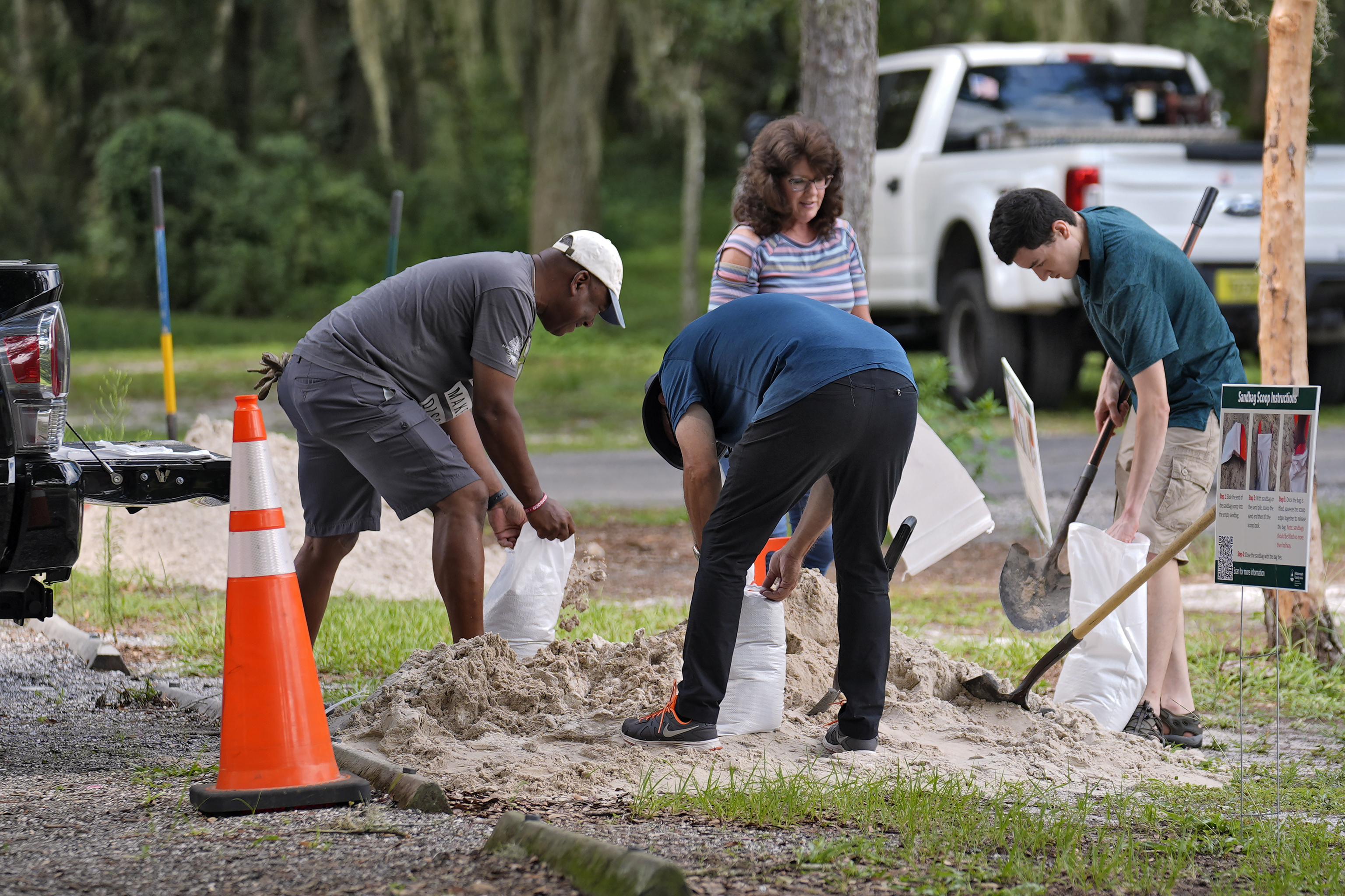
In Tampa alone, officials gave out more than 30,000 sandbags to barricade against flooding.
"We've got our stormwater drains cleared out. We've got our generators all checked and full. We're doing everything that we need to be prepared to face a tropical storm," Tampa Mayor Jane Castor said.
On Friday, crews pulled floating cranes away from a bridge construction project across Tampa Bay, lashing together 74 barges and 24 floating cranes and anchoring them, project engineer Marianne Brinson told the Tampa Bay Times. Crews also laid down cranes on land on their sides.
For some, the name Debby summons bad memories of a 2012 tropical storm of the same name that caused $250 million in losses and eight deaths, including seven in the Sunshine State. That storm dumped torrential rains, including an astronomical 29 inches (730 mm) south of Tallahassee.
