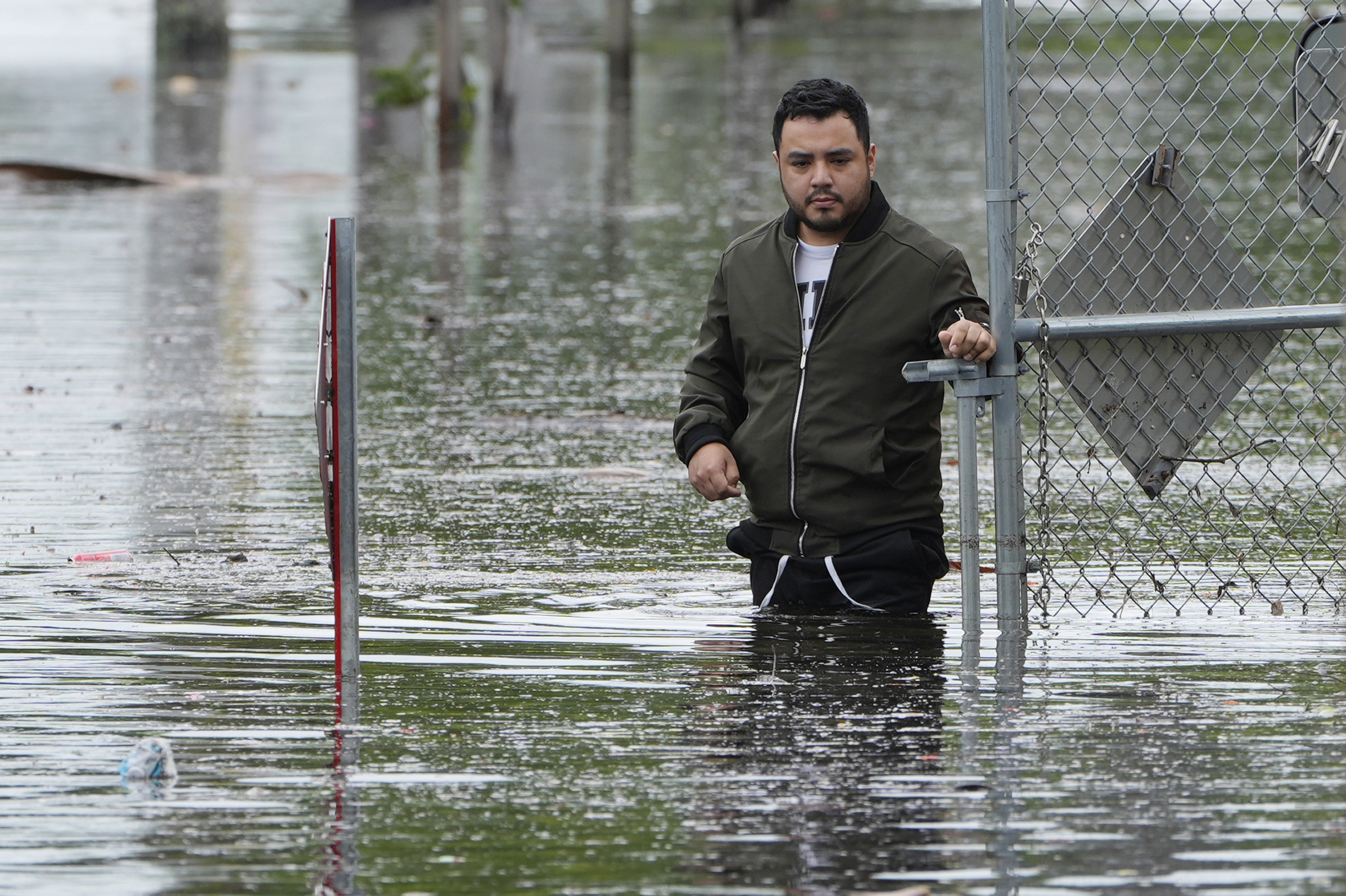
A series of storms flowing from the Gulf of Mexico swamped South Florida with flash floods that stalled cars, forced the cancellation of dozens of flights and generally made life miserable for tens of thousands of people.
Flat Florida is prone to flooding even on sunny days when so-called king tides surge in coastal areas. And tropical storms and hurricanes can trigger river flooding and overwhelm drainage systems and the region's canals.
Here's what you need to know about Florida's latest floods.
The National Weather Service estimates that from Tuesday through Wednesday about 20 inches (50 centimeters) of rain deluged the hardest-hit spots, including Hallandale Beach and Hollywood, both near Fort Lauderdale, and roughly the same amount in North Miami.
Miami Beach, which frequently floods in less powerful storms, got about 13 inches (33 centimeters).
Forecasts call for more rain Thursday that would likely cause additional flooding because the ground is already saturated.
June is typically the wettest month in Miami, with annual average rainfall of more than 10 inches (25 centimeters), said Alex DaSilva, AccuWeather's lead hurricane forecaster.
"What is unusual is how much rain South Florida has seen in such a short period of time," DaSilva said.
It has happened many times before. In one recent example, Fort Lauderdale was hit hard in April 2023 with record rainfall totals ranging from 15 inches (38 centimeters) to 26 inches (66 centimeters). Many homes and businesses were flooded — and some are experiencing the same thing again.
Two persistent weather systems are behind the Florida floods, DaSilva said.
One is an area of high pressure off the southeastern coast that spins clockwise. The other is what forecasters call the "central American gyre," a low-pressure area of storms spinning counterclockwise in the western Caribbean Sea that appears every spring.
"These two features essentially created a channel that funneled moisture from the Caribbean up and into Florida," DaSilva said. "It is essentially a fire hose turned on jet mode. We also have a stalled front across Florida, which has helped to enhance the precipitation."
Florida differs from other places prone to flash flooding because it is flat and doesn't have dry riverbeds or gullies that suddenly become raging torrents capable of washing away entire buildings.
In Florida, the heavy rains can overwhelm drainage and pumping systems, leaving the water nowhere to go. So it can suddenly switch from a few inches to a couple feet of water in a roadway in a matter of minutes — enough to stall a car engine and make it float away.
On Wednesday, the National Weather Service in Miami issued a rare flash flood emergency, which forecasters define as conditions that are imminently life-threatening or likely to cause property damage. In this case, it was mostly about vehicles stuck on flooded roads. About half of flood deaths happen to people who can't escape their cars.
A flash flood watch remains in effect in South Florida through Friday, the National Weather Service said.
Drought conditions existed before these storms in many parts of Florida, especially the Gulf Coast from the Tampa Bay area south to Fort Myers and Naples.
It got so bad in Sarasota that officials declared a drought emergency and urged people to conserve water until the annual rainy season began — usually around the same time as the June 1 start of hurricane season, which lasts until Nov. 30.
Parts of Sarasota got pummeled with 8 inches (20 centimeters) of rain in a single hour Tuesday, an event weather forecasters say happens only every 500 years. Significant rainfall happened in other sections of the county as well.
"This rainfall should eliminate most, if not all of the drought conditions across South Florida," DaSilva said.
